Cannes Maps and Orientation
(Cannes, Alpes-Maritimes, Provence-Alpes-Cote d'Azur, France)
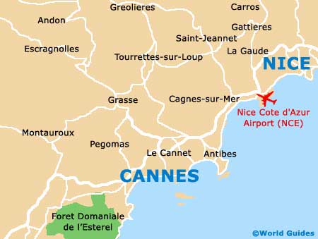
Located on the southern side of France and within the beautiful Provence-Alpes-Côte d'Azur region, the resort city of Cannes is known for its constant sunshine. Cannes enjoys a coastal setting next to the Mediterranean Sea (Mer Méditerranée) and is just a short drive from the cities of
Nice and Monaco, both of which lie to the north-east.
Also close to the Maritime Alps, Cannes is famous for its sandy beaches, which are based around the Boulevard de la Croisette. This scenic waterfront promenade heads eastwards from the Palais des Festivals et des Congrés and past the Baie de Cannes, towards the Pointe de la Croisette.
Maps and Orientation of the City
Within Cannes itself, visitors will soon realise that the Rue d'Antibes is a prominent local thoroughfare and an important street for shopping. The city's train station lies directly south and can be found along the Rue Jean Jaurès.
The Old Town quarter of Cannes, otherwise known as the 'Le Suquet' district, lies directly west of the city's Vieux Port and is where many of the best historical attractions reside. A bus station is located is this part of Cannes and offers regular trips to Nice and other neighbouring destinations.
- Antibes - 11 km / 7 miles (12 minutes, north-east)
- Biot - 18 km / 11 miles (20 minutes, north-east)
- Cagnes-Sur-Mer - 22 km / 14 miles (25 minutes, north-east)
- Fréjus - 42 km / 26 miles (40 minutes, south-west)
- Grasse - 19 km / 12 miles (20 minutes, north-west)
- Mandelieu-La-Napoule - 13 km / 8 miles (15 minutes, west)
- Monaco - 54 km / 34 miles (45 minutes, north-east)
- Nice - 35 km / 22 miles (30 minutes, north-east)
- Pégomas - 14 km / 9 miles (18 minutes, north-west)
- Saint-Jean - 8 km / 5 miles (10 minutes, west)
- Saint-Raphael - 43 km / 27 miles (40 minutes, south-west)
- Vallauris - 6 km / 4 miles (10 minutes, north-east)
Map of France

Map of Cannes